Solutions
Platform overview
Relying on GIS technology, 3D BIM technology, massive data management technology, Internet of Things (IoT), and Mobile Internet technology, we have developed a intelligent drainage 3D GIS management platform. This platform integrates pipeline network data entry, unified data management, IoT access and real-time monitoring, and decision-making scheduling into a comprehensive application. It achieves full-process coverage of various pipeline network data from surveying and design to data storage and application management.
By establishing a multi-parameter drainage system operation model, we can monitor, provide early warnings, and diagnose the drainage network's operating status in real time. This helps to timely discover potential problems and implement intelligent operations and maintenance through a workflow-based closed-loop management process, ultimately ensuring the long-term stable and healthy operation of the drainage system.
-
-
-
Overview
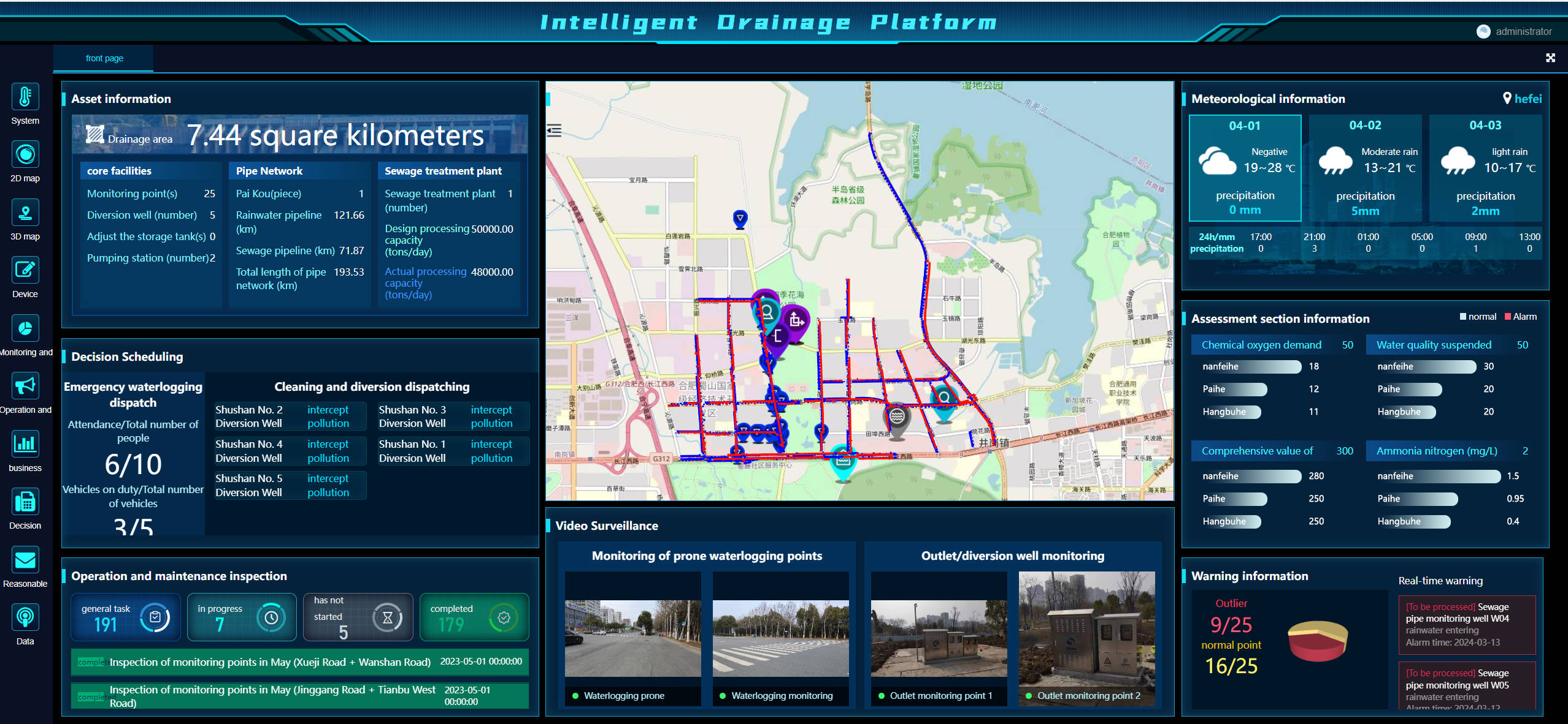
The homepage provides an overview that displays relevant project information, divided into Asset Information, Decision Dispatch, Operation and Maintenance Inspection, Video Surveillance, Meteorological Information, Assessment Sections, Early Warning Information, and Project Map Display. The function menu on the left allows for navigation to each of these modules.
-
-
-
-
2D map view
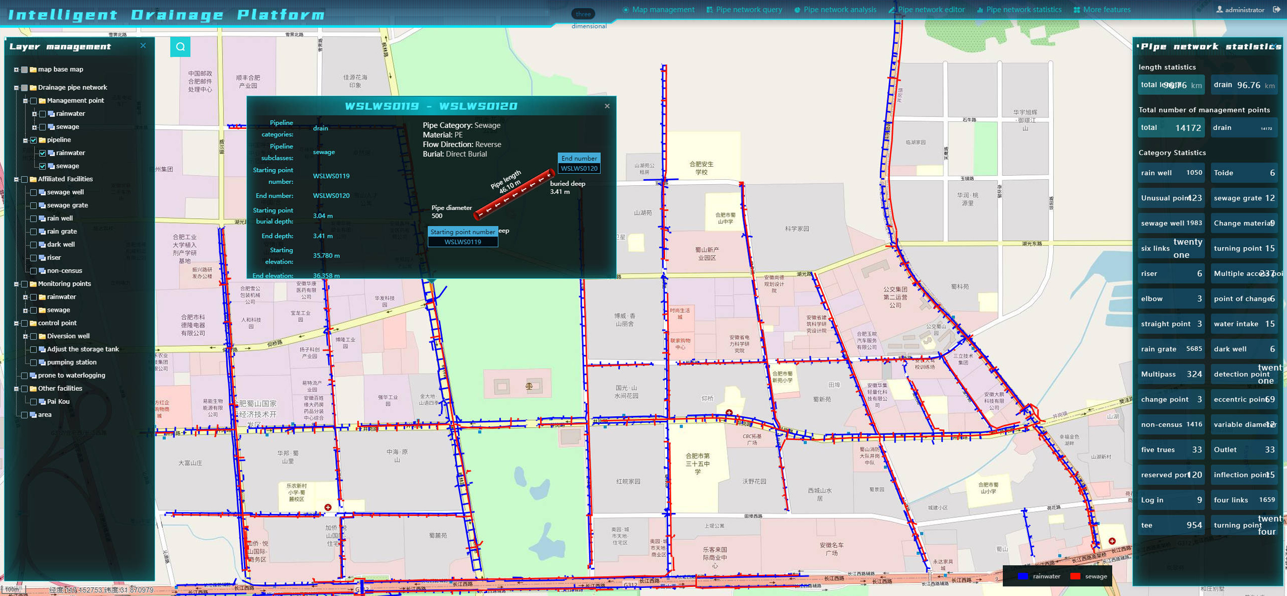
The 2D map module utilizes GIS technology to display information related to the pipeline network. The map supports layer switching, pipeline network queries, pipeline network analysis, and other functions. The pipelines on the map can be clicked to view detailed information. Points of warning and alert are prominently displayed with distinctive icons.
-
-
-
-
3D map view
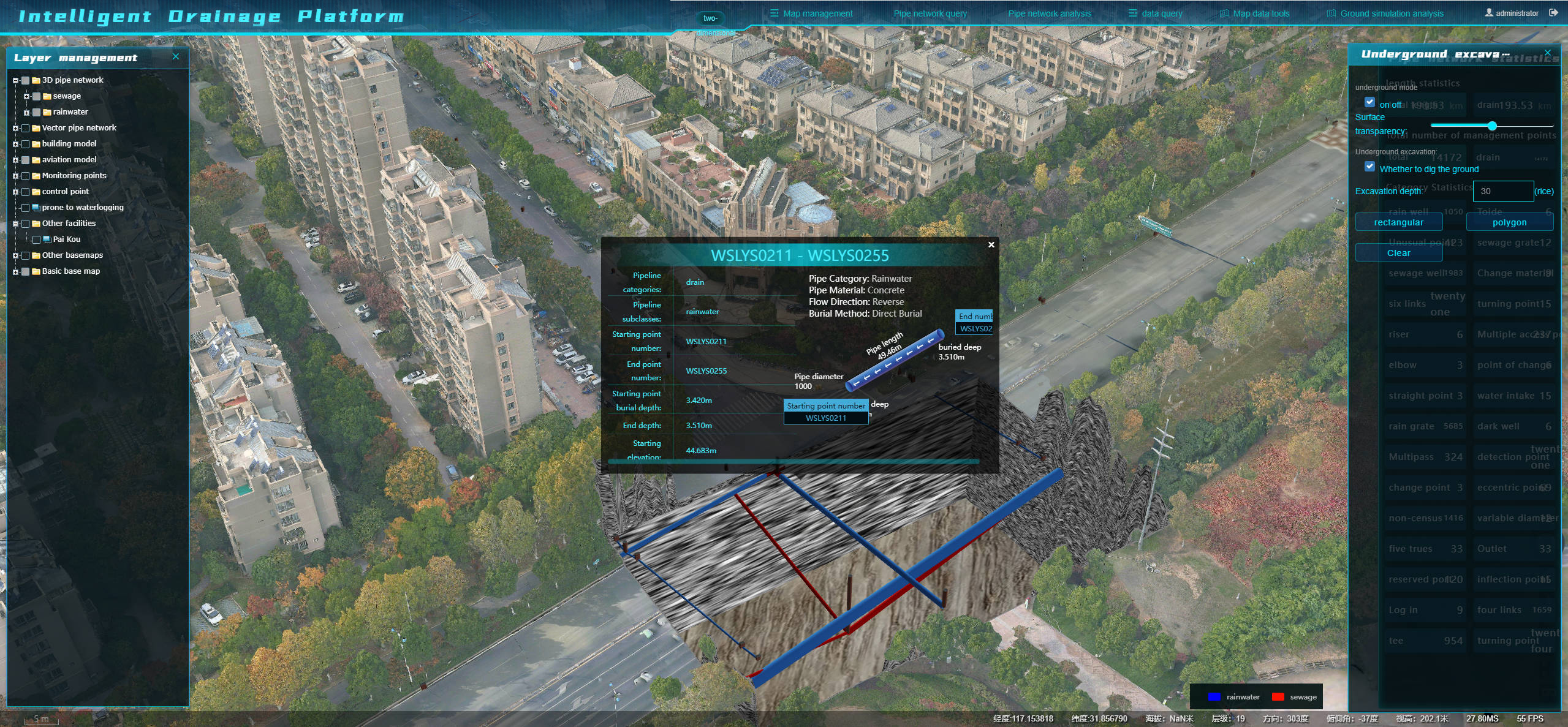
The 3D map feature leverages the power of three-dimensional GIS technology to vividly showcase details about the pipeline network. It comes equipped with a variety of useful tools, including the ability to switch between layers, search and analyze the network, display pipeline models, and perform excavations. Users can easily click on any part of the network on the map to access in-depth information. Additionally, points that signal alerts or warnings stand out with eye-catching icons.
-

